


Data capture
Aerial pictures of your entire plantation are captured by VETAL, Vespa Hex or others.
Data upload
Simply upload your crop images and other gathered data from the drone to our cloud system.
Data processing
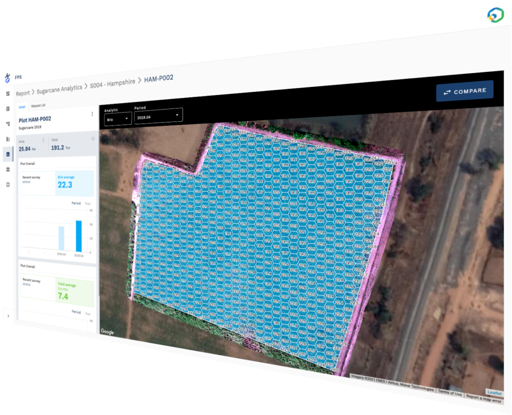
HiveGrid platform will extract information to help manage your plantation.